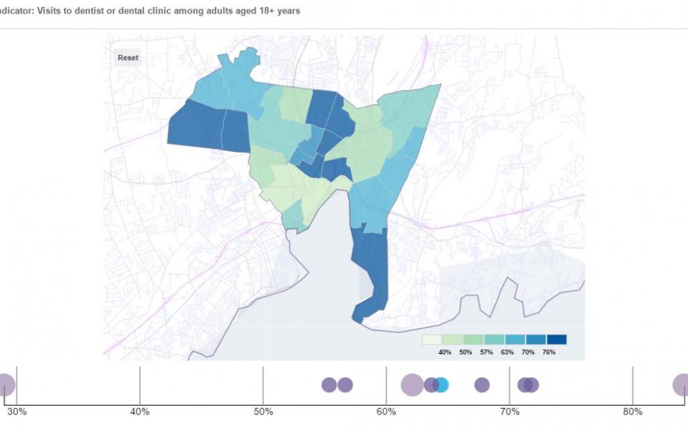
Connecticut City Neighborhood Profiles
With support from public and private partners, DataHaven has collected the latest data for neighborhoods throughout Connecticut for over 20 years. Unlike many other online maps, the data visualization technology we use is highly responsive across various mobile devices.
2024 City Neighborhood Profiles
After viewing the visualization, click on the "X" in the top right to return to this page.
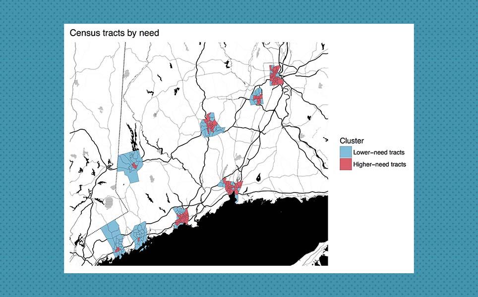
2020 Census Analysis and Town Equity Reports
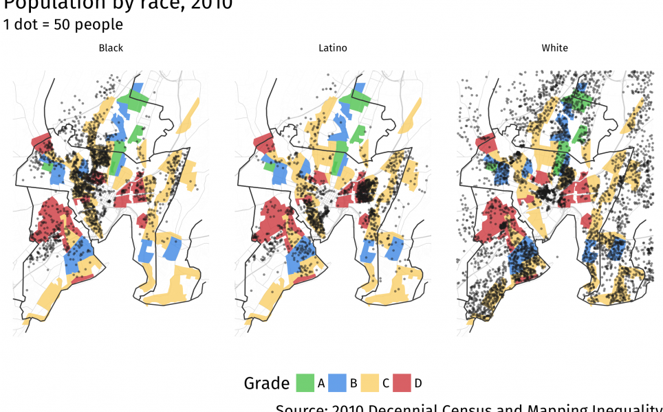
Our report, 2020 Census Data: Demographic Change in Connecticut Town and City Neighborhoods, contains maps and analyses of changes since the 2010 Census, based on local results from the 2020 Census that were first released in August 2021. Our Connecticut Town Equity Reports also contain local maps for all 169 towns in the state.
Prior versions
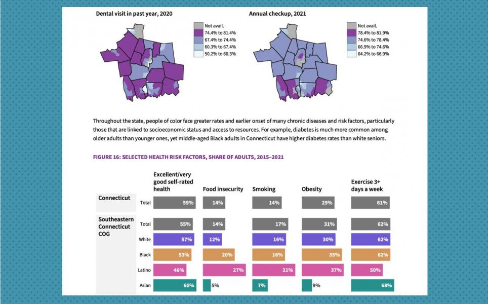
View the 2020 edition of the profiles by clicking here.
View the 2019 edition of the profiles by clicking here.

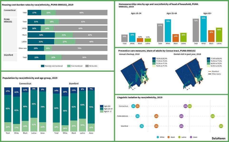
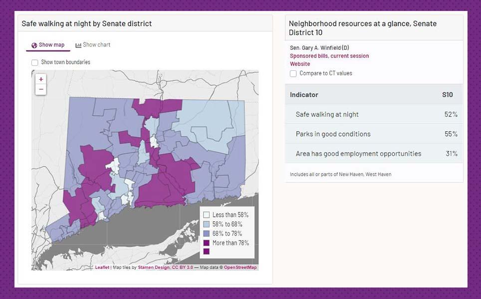
Connecticut Legislative Districts
Profiles are also available for Connecticut legislative districts.
Open Data
Links to download the raw data are embedded within the visualization itself (see links at bottom of the data viewer), and also may be linked from the resources library of our main website. Please contact us if you have any issues accessing these data files.
More Information
Please contact us with any questions. Data for other Connecticut communities, towns, and areas are posted on our communities page, and in our Town Equity Reports.