Valley Updating Community Health Plan
Valley Independent Sentinel August 9, 2016
(Excerpt from full article, posted at the Valley Independent Sentinel website) … Read More
Cancer, heart disease top killers in Norwalk
The Hour July 14, 2016
[Excerpt - see full article at http://www.thehour.com/news/article/Cancer-heart-disease-top-killers-in-...By Robert Koch Thursday, July 14, 2016… Read More
Yale survey finds New Haven low-income areas feel safer, but health worries remain
New Haven Register May 9, 2016
[Excerpt] "For added context, the review included findings from DataHaven’s Community Wellbeing Survey. This phone survey was taken with more than 16,000 randomly selected adults throughout the state and 800 in the city of New Haven between April and October 2015.… Read More
New Data Shows New Haven's Promise
by Anonymous April 20, 2016
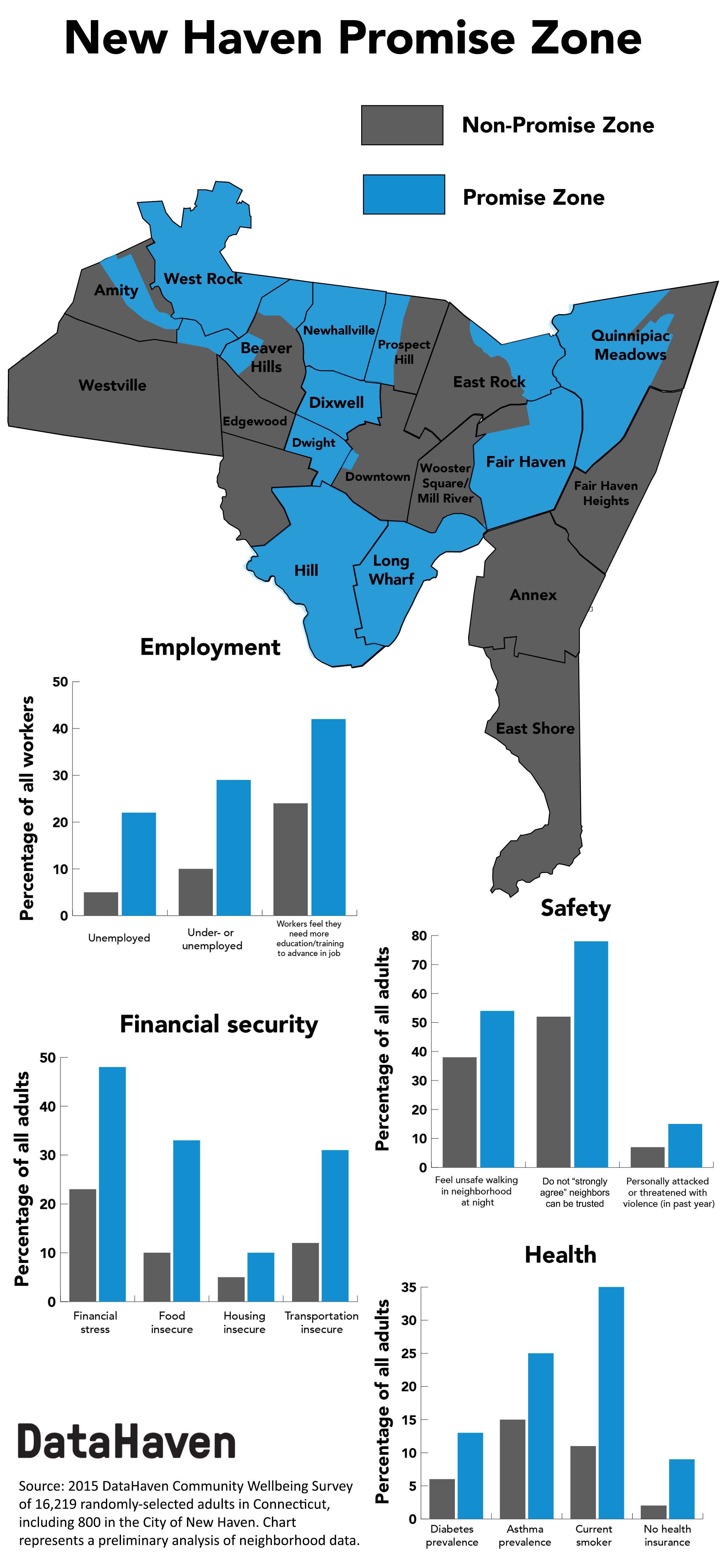
BY APARNA NATHANIn January, the City of New Haven submitted its second application for a federal “Promise Zone” designation, one year after its original application was selected as a finalist but not advanced to be one of the six designated zones that year.… Read More
Cig Smoking Drops, E-Smoking Rises
by Anonymous March 8, 2016
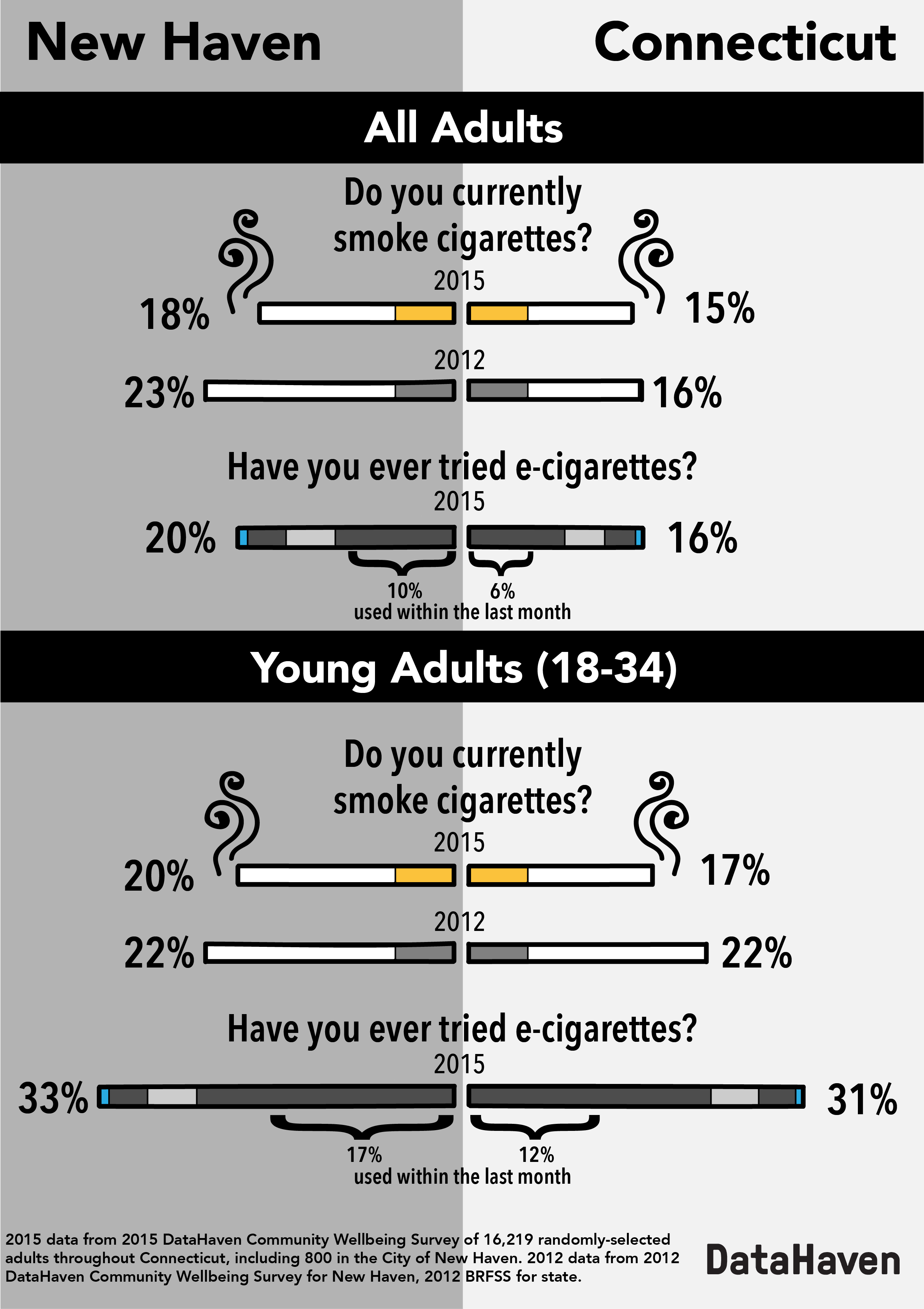
BY APARNA NATHANNEW HAVEN, CT - Cigarette smoking is on the decline in New Haven, according to new community-level data.… Read More
DataHaven Community Wellbeing Survey Featured on WNPR Where We Live: Transcript
by Mark Abraham February 21, 2016
WNPR's live radio program, Where We Live, recently hosted Mark Abraham, Executive Director of DataHaven, and Anita Chandra, Director of RAND Justice, Infrastructure, and Environment, to discuss findings from the … Read More


